03·3D & Spatial
Dubai Digital Twin
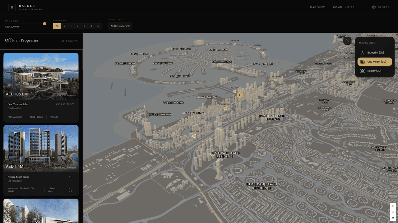
City-scale Gaussian Splatting twin of Dubai. Combines the 3DGS pipeline with Google Street View capture to produce georeferenced building scans. Unified scan-to-floorplan pipeline derives room geometry directly from point clouds. The Onyx Tower is the first live tile in the BARNES property-search flow.
What it took
The skills behind this project.
Every project below leans on a primary discipline and a handful of secondary ones. Tap any chip to see how that skill plays out across the wider portfolio.
Skills demonstrated
- 3D & SpatialPrimary
City-scale 3DGS combined with Street View capture; georef alignment per building.
- Backend EngineeringSecondary
Unified scan-to-floorplan pipeline that derives room geometry directly from point clouds.
- Frontend EngineeringSecondary
Cesium tile integration into the existing property-search flow with no flow disruption.
- Data PipelinesSupporting
Street View tile orchestration plus dedupe and quality gating per neighbourhood.
Context
Why it exists.
A property-search flow that lists buildings as text and a thumbnail makes no use of where the building actually sits — what it overlooks, which side gets the afternoon sun, how far you walk to the metro. A city-scale 3D twin lets the search experience answer those questions directly, with the building you are considering pinned inside it.
Dubai Digital Twin is the substrate. City-scale 3DGS coverage combined with Google Street View capture for the texture-rich ground level, georeferenced building-by-building so each scan tile sits where its real-world coordinates put it. The first georeferenced tile — Onyx Tower — is already live inside the BARNES Dubai property-search flow.
It is also the layer the unified scan-to-floorplan pipeline reads from: room geometry derived directly from the point cloud, no intermediate hand-drawn floorplan step.
Stack3DGS · Cesium · Google Street View · COLMAP · gsplat
Process
The decisions that shaped it.
- 01
Street View as a complement, not a substitute
Self-captured 3DGS handles the buildings; Street View covers the ground plane and the street furniture you would never scan on purpose. Stitching them required reconciling two very different texture resolutions and projection conventions, but the result is a twin that looks plausible at both block scale and city scale without a separate ground capture campaign.
3D & Spatial - 02
Georef per building, not per district
Bulk georef-by-district is fast but wrong — buildings drift relative to each other by several metres, which kills the value proposition (you cannot say `this apartment overlooks the marina` if the marina is three buildings to the left). Aligned each building tile individually against survey markers, which is slower but is the only way the property-search overlay actually means what it says.
Backend Engineering - 03
Scan-to-floorplan from the point cloud
Room geometry derived directly from the 3DGS point cloud, not from a hand-drawn floorplan. The same scan that ships into the viewer also produces the floorplan inset on the property card, with consistent dimensions and orientation. One source of truth instead of two — broker-drawn floorplans no longer contradict the scan.
Data Pipelines - 04
Cesium integration without breaking the search flow
Property search is the existing surface buyers use; the twin had to slot in beside it, not replace it. Cesium tiles are mounted as a swap-in viewport on the property card — the same card that previously held five photos. No new URL, no separate app, no learning curve.
Frontend Engineering
Outcome
What shipped.
LiveFirst georeferenced building (Onyx Tower) live in BARNES Dubai's property-search flow.
Onyx Tower is live as the first tile in the BARNES Dubai property-search flow. Subsequent buildings join the twin as their scan-georef-publish cycle completes. The pipeline supports both scanned and AI-generated tiles, so unbuilt off-plan properties slot into the same map alongside completed buildings.