
02·3D & Spatial
Barnes Vantage
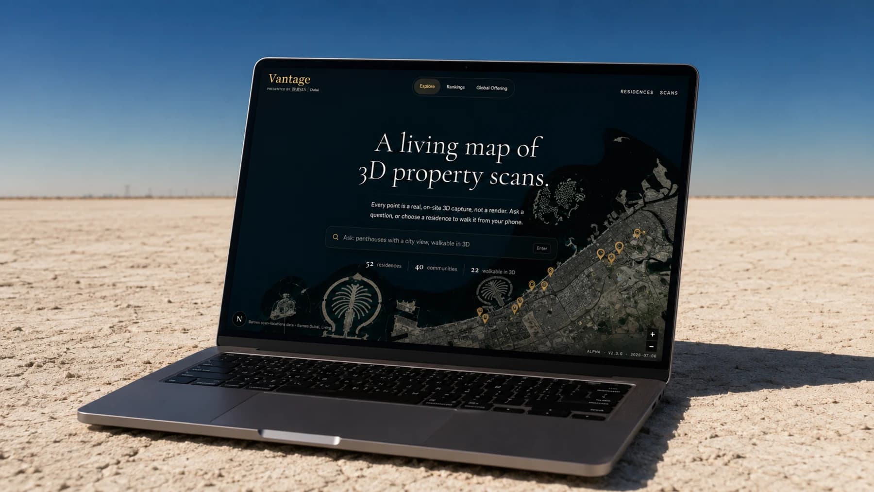
An international portal for viewing real Dubai residences in 3D: a buyer could walk any of them in the browser, or have a broker drive the same walkthrough live while they followed on their own device.
Consolidated three former tools, marketplace, scan viewer, and co-browse, into one platform, marketplace-first.
[ Walk the live 3D scan ]Why it exists.
The pieces already existed at BARNES Dubai: a library of real 3D scans, a walkable viewer shipped on the property pages, a valuation signal, a marketplace of curated listings. They lived on separate apps, and every switch between them lost the thread.
Barnes Vantage was an international viewing portal: a living map of Dubai where every point was a real on-site Gaussian-splat capture, not a render. You could ask a question in plain language and read which communities were best covered before opening a scan.
Sales Showroom, Dubai Internet City
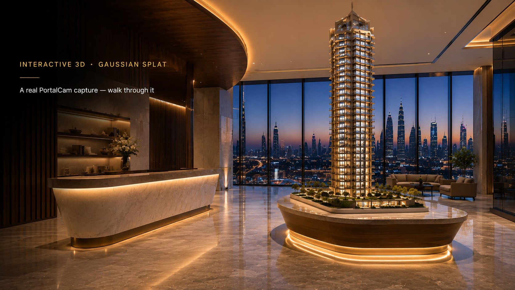
The viewer Vantage drops you into when you open a residence. A real PortalCam capture of the showroom, 2M Gaussians on desktop, rendered live in your browser. WASD to walk, Q/E for height, drag to look, scroll to zoom.
The brief.
Let anyone, anywhere in the world, open a map of real Dubai residences and walk a real 3D scan of one, live, the same way a broker in the room would show it.
What it took
Skills behind it.
Primary discipline plus the support stack.
Skills demonstrated
- Frontend Engineering
Interface worked out by iteration, map-led through mid-2026: MapLibre canvas, natural-language search, and the analytics panels tested against live scan data.
- 3D & Spatial
Moved the walkable scan onto gaussian-splats-3d, shared with the standalone Splat Viewer through barnes-scan-viewer, and set the qualification gate behind the Verified by Vantage badge.
- Product Strategy
One operator surface where three separate broker apps used to be.
- Backend Engineering
Self-hosted WebSocket relay for broker-led co-browse, assembled through trial and error.
The build, in full.
How it came together, the decisions on the record, and the design system - kept off this page so the case study stays a read, not a scroll.
Read the full build notesWhat shipped.
Consolidated three former tools, marketplace, scan viewer, and co-browse, into one platform, marketplace-first. Scans were published under a written Verified by Vantage standard.
Ran as a live pilot, not a demo, until BARNES Dubai ceased operations in 2026: stress-tested under load, a memory-streaming fix proven live, and every dead button found by checking real fetch calls against real routes, one at a time.
last confirmed live 2026-07-29; not independently re-verifiable this pass
last confirmed live 2026-07-29; not independently re-verifiable this pass
status "live" with a scan path in scan-locations.json as of 2026-07-31; the rest are coming_soon
The paper-to-product thread this project sits inside. The full chain, paper through benchmark to shipped, is on the thread.
- 3D Gaussian SplattingSee thread
Turning ordinary photographs of a real place into a 3D scene you can walk through in a browser.
- Web renderer selectionSee thread
Which renderer can actually hold a nine-million-splat scan in a browser.
- VSLSSee thread
A vendor-neutral spec for verifying and integrating 3D Gaussian Splatting scans.
See also
3DGS Research Pipeline
A reproducible harness with 26 Gaussian-splat engines wired into it, scoring which reconstruction survives a real luxury interior.
Relighting a Real Scan
Per-Gaussian relighting of a real 3D Gaussian-splat capture in the browser, driven by a real solar ephemeris, with the negative results reported alongside.
Scan to Floor Plan
Turning a 3D scan into a drawn-to-scale floor plan, and the measured finding that the machine-learning version lost to a far simpler method.